shift_and_rotate() shifts a SpatVector or a
SpatRaster by a specified horizontal distance and
rotates the data around the
International Date Line.
This function is particularly useful for working with rasters and vectors that span the date line (e.g., the Russian territory).
Arguments
- x
A
SpatVectororSpatRasterobject to be shifted and rotated.- dx
(optional) A number indicating the amount of the horizontal shift in degrees. Positive values shift to the right, negative values shift to the left (default:
-45).- precision
(optional) An integer number specifying the number of decimal digits to use when rounding longitude and latitude coordinates (default:
5).- overlap_tolerance
(optional) A number specifying the tolerance for overlapping geometries when combining vectors. This value controls the allowable error when merging overlapping geometries (default:
0.1).
Value
A object of the same class as x that has been shifted and rotated
by the specified amount in degrees.
See also
Other terra functions:
shift_and_crop()
Examples
# Set the Environment -----
library(dplyr)
library(geodata)
library(ggplot2)
library(httr2)
library(magrittr)
library(terra)
library(tidyterra)
plot_vector <- function(vector) {
plot <-
vector |>
ggplot() +
geom_spatvector(fill = "#3243A6", color = "white")
print(plot)
}
plot_raster <- function(raster) {
plot <-
ggplot() +
geom_spatraster(data = raster) +
scale_fill_continuous(
palette = c("#072359", "#3243A6", "#9483AF"),
na.value = "white"
) +
labs(fill = NULL) +
theme(
axis.ticks.x = element_blank(),
axis.text.x = element_blank(),
axis.ticks.y = element_blank(),
axis.text.y = element_blank()
)
print(plot)
}
# Vector Example -----
## Define the Vector
# \dontrun{
if (is_online()) {
russia_vector <- gadm(country = "rus", level = 0, path = tempdir())
}
# }
## Visualize the Vector
# \dontrun{
if (is_online()) {
russia_vector |> plot_vector()
}
 # }
## Shift and Rotate the Vector -45 Degrees to the Left
# \dontrun{
if (is_online()) {
russia_vector |> shift_and_rotate(-45) |> plot_vector()
}
# }
## Shift and Rotate the Vector -45 Degrees to the Left
# \dontrun{
if (is_online()) {
russia_vector |> shift_and_rotate(-45) |> plot_vector()
}
 # }
## Shift and Rotate the Vector 45 Degrees to the Right
# \dontrun{
if (is_online()) {
russia_vector |> shift_and_rotate(45) |> plot_vector()
}
# }
## Shift and Rotate the Vector 45 Degrees to the Right
# \dontrun{
if (is_online()) {
russia_vector |> shift_and_rotate(45) |> plot_vector()
}
 # }
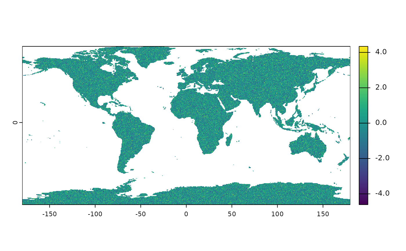
# Raster Example -----
## Define the Raster
# \dontrun{
if (is_online()) {
raster <-
expand.grid(
seq(-179.75, 179.75, by = 0.5),
seq(-89.75, 89.75, by = 0.5)
) |>
as_tibble() |>
rename(x = Var1, y = Var2) |>
mutate(value = rnorm(259200)) |>
rast(type = "xyz") %>%
`crs<-`("epsg:4326")
world_shape <- world(path = tempdir())
raster <- raster |> crop(world_shape, mask = TRUE)
}
# }
## Visualize the Raster
# \dontrun{
if (is_online()) {
raster |> plot_raster()
}
# }
# Raster Example -----
## Define the Raster
# \dontrun{
if (is_online()) {
raster <-
expand.grid(
seq(-179.75, 179.75, by = 0.5),
seq(-89.75, 89.75, by = 0.5)
) |>
as_tibble() |>
rename(x = Var1, y = Var2) |>
mutate(value = rnorm(259200)) |>
rast(type = "xyz") %>%
`crs<-`("epsg:4326")
world_shape <- world(path = tempdir())
raster <- raster |> crop(world_shape, mask = TRUE)
}
# }
## Visualize the Raster
# \dontrun{
if (is_online()) {
raster |> plot_raster()
}
 # }
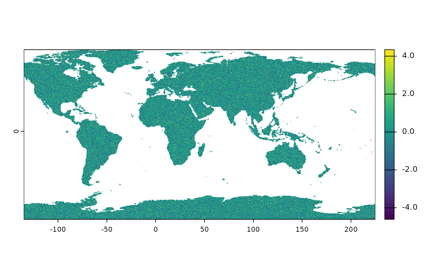
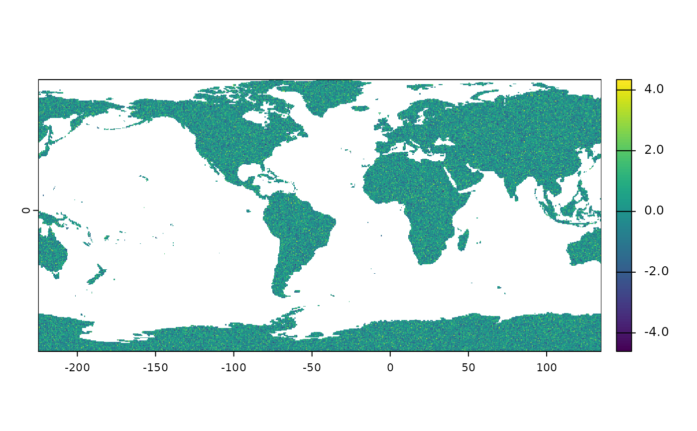
## Shift and Rotate the Vector -45 Degrees to the Left
# \dontrun{
if (is_online()) {
raster |> shift_and_rotate(-45) |> plot_raster()
}
# }
## Shift and Rotate the Vector -45 Degrees to the Left
# \dontrun{
if (is_online()) {
raster |> shift_and_rotate(-45) |> plot_raster()
}
 # }
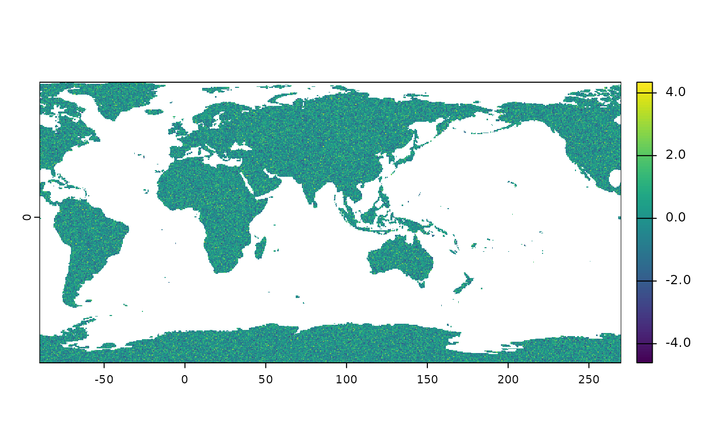
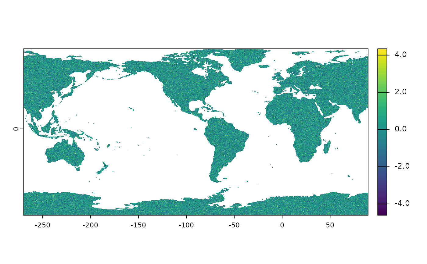
## Shift and Rotate the Vector -90 Degrees to the Left
# \dontrun{
if (is_online()) {
raster |> shift_and_rotate(-90) |> plot_raster()
}
# }
## Shift and Rotate the Vector -90 Degrees to the Left
# \dontrun{
if (is_online()) {
raster |> shift_and_rotate(-90) |> plot_raster()
}
 # }
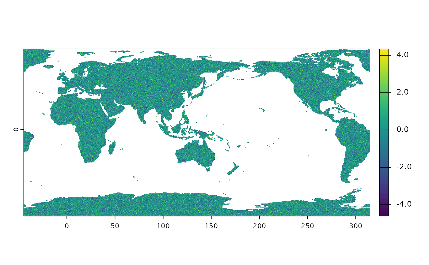
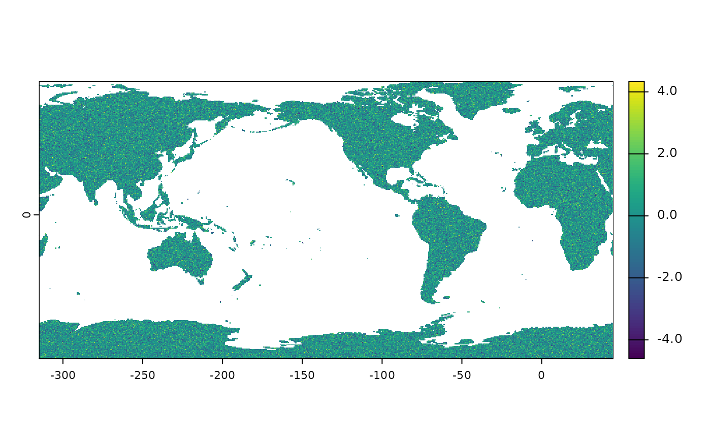
## Shift and Rotate the Vector -135 Degrees to the Left
# \dontrun{
if (is_online()) {
raster |> shift_and_rotate(-135) |> plot_raster()
}
# }
## Shift and Rotate the Vector -135 Degrees to the Left
# \dontrun{
if (is_online()) {
raster |> shift_and_rotate(-135) |> plot_raster()
}
 # }
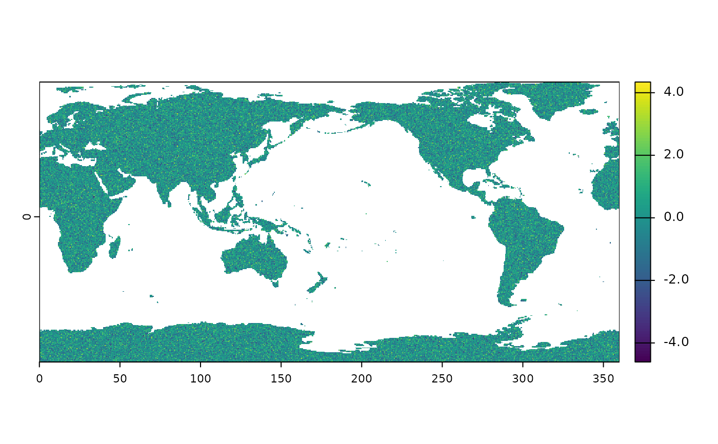
## Shift and Rotate the Vector -180 Degrees to the Left
# \dontrun{
if (is_online()) {
raster |> shift_and_rotate(-180) |> plot_raster()
}
# }
## Shift and Rotate the Vector -180 Degrees to the Left
# \dontrun{
if (is_online()) {
raster |> shift_and_rotate(-180) |> plot_raster()
}
 # }
## Visualize the Raster
# \dontrun{
if (is_online()) {
raster |> plot_raster()
}
# }
## Visualize the Raster
# \dontrun{
if (is_online()) {
raster |> plot_raster()
}
 # }
## Shift and Rotate the Vector 45 Degrees to the Right
# \dontrun{
if (is_online()) {
raster |> shift_and_rotate(45) |> plot_raster()
}
# }
## Shift and Rotate the Vector 45 Degrees to the Right
# \dontrun{
if (is_online()) {
raster |> shift_and_rotate(45) |> plot_raster()
}
 # }
## Shift and Rotate the Vector 90 Degrees to the Right
# \dontrun{
if (is_online()) {
raster |> shift_and_rotate(90) |> plot_raster()
}
# }
## Shift and Rotate the Vector 90 Degrees to the Right
# \dontrun{
if (is_online()) {
raster |> shift_and_rotate(90) |> plot_raster()
}
 # }
## Shift and Rotate the Vector 135 Degrees to the Right
# \dontrun{
if (is_online()) {
raster |> shift_and_rotate(135) |> plot_raster()
}
# }
## Shift and Rotate the Vector 135 Degrees to the Right
# \dontrun{
if (is_online()) {
raster |> shift_and_rotate(135) |> plot_raster()
}
 # }
## Shift and Rotate the Vector 180 Degrees to the Right
# \dontrun{
if (is_online()) {
raster |> shift_and_rotate(180) |> plot_raster()
}
# }
## Shift and Rotate the Vector 180 Degrees to the Right
# \dontrun{
if (is_online()) {
raster |> shift_and_rotate(180) |> plot_raster()
}
 # }
# }