shift_and_crop() shifts and rotates a SpatRaster by
a specified horizontal distance, then crops it to the extent of a
SpatVector that has been similarly transformed.
This function is particularly useful for working with rasters and vectors that span the International Date Line (e.g. the Russian territory).
Arguments
- raster
A
SpatRasterobject to be shifted, rotated, and cropped.- vector
A
SpatVectorobject to be shifted and rotated.- dx
(optional) A number indicating the amount of the horizontal shift in degrees. Positive values shift to the right, negative values shift to the left (default:
-45).- precision
(optional) An integer number specifying the number of decimal digits to use when rounding longitude and latitude coordinates (default:
5).- overlap_tolerance
(optional) A number specifying the tolerance for overlapping geometries when combining vectors. This value controls the allowable error when merging overlapping geometries (default:
0.1).- ...
Additional arguments passed to
crop().
Value
A SpatRaster object that has been shifted
and rotated by the specified amount in degrees, then cropped to the extent
of the provided vector.
See also
Other terra functions:
shift_and_rotate()
Examples
# Set the Environment -----
library(httr2)
library(dplyr)
library(geodata)
library(ggplot2)
library(terra)
library(tidyterra)
#>
#> Attaching package: ‘tidyterra’
#> The following object is masked from ‘package:stats’:
#>
#> filter
plot_vector <- function(vector) {
plot <-
vector |>
ggplot() +
geom_spatvector(fill = "#3243A6", color = "white")
print(plot)
}
plot_raster <- function(raster) {
plot <-
ggplot() +
geom_spatraster(data = raster) +
scale_fill_continuous(
palette = c("#072359", "#3243A6", "#9483AF"),
na.value = "white"
) +
labs(fill = NULL)
print(plot)
}
# Define the SpatVector -----
# \dontrun{
if (is_online()) {
russia_vector <- gadm(country = "rus", level = 0, path = tempdir())
russia_vector |> plot_vector()
}
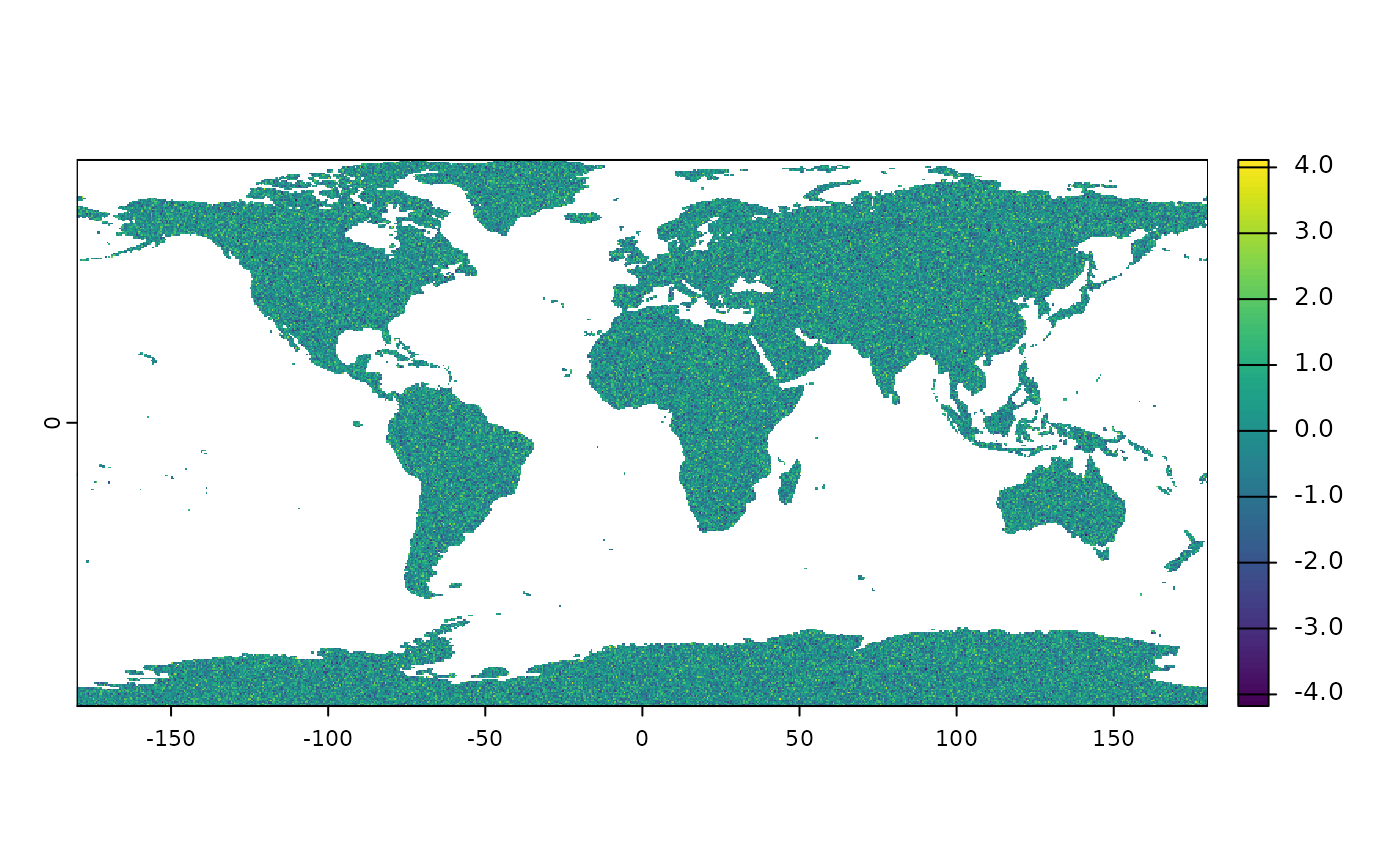 # }
# Define the SpatRaster -----
# \dontrun{
if (is_online()) {
raster <-
expand.grid(
seq(-179.75, 179.75, by = 0.5),
seq(-89.75, 89.75, by = 0.5)
) |>
as_tibble() |>
rename(x = Var1, y = Var2) |>
mutate(value = rnorm(259200)) |>
rast(type = "xyz") %>%
`crs<-`("epsg:4326")
world_shape <- world(path = tempdir())
raster <- raster |> crop(world_shape, mask = TRUE)
}
# }
# Visualize the SpatRaster -----
# \dontrun{
if (is_online()) {
raster |> plot_raster()
}
# }
# Define the SpatRaster -----
# \dontrun{
if (is_online()) {
raster <-
expand.grid(
seq(-179.75, 179.75, by = 0.5),
seq(-89.75, 89.75, by = 0.5)
) |>
as_tibble() |>
rename(x = Var1, y = Var2) |>
mutate(value = rnorm(259200)) |>
rast(type = "xyz") %>%
`crs<-`("epsg:4326")
world_shape <- world(path = tempdir())
raster <- raster |> crop(world_shape, mask = TRUE)
}
# }
# Visualize the SpatRaster -----
# \dontrun{
if (is_online()) {
raster |> plot_raster()
}
 # }
# Shift, Rotate and Crop the SpatRaster -----
# \dontrun{
if (is_online()) {
raster <- raster |> shift_and_crop(russia_vector, -45)
}
# }
# Visualize the SpatRaster After Shift and Crop -----
# \dontrun{
if (is_online()) {
raster |> plot_raster()
}
# }
# Shift, Rotate and Crop the SpatRaster -----
# \dontrun{
if (is_online()) {
raster <- raster |> shift_and_crop(russia_vector, -45)
}
# }
# Visualize the SpatRaster After Shift and Crop -----
# \dontrun{
if (is_online()) {
raster |> plot_raster()
}
 # }
# }